
Harnessing the Power of Machine Learning for Spatial Data Analysis
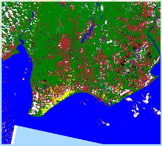
The rapid growth of geospatial data in recent years has been staggering. According to a report by Geospatial Media and Communications, the global geospatial analytics market is expected to reach $96.3 billion by 2027, at a CAGR of 16.9% from 2020 to 2027. This explosion of spatial data is driven by advancements in remote sensing technologies, IoT sensors, mobile devices, and location-based services.
However, the sheer volume, variety, and complexity of this data presents significant challenges for traditional spatial analysis methods. This is where machine learning comes in. By leveraging the power of AI and ML techniques, geospatial analysts and data scientists can uncover hidden patterns, make more accurate predictions, and extract actionable insights from their spatial data.
In this comprehensive guide, we‘ll dive deep into the world of machine learning for spatial data analysis. We‘ll explore the unique characteristics of spatial data, the key ML techniques and tools used in the geospatial industry, and real-world examples of how these cutting-edge approaches are being applied across various domains.
Understanding the Unique Challenges of Spatial Data
Spatial data, also known as geospatial data, refers to any data that has a geographic or locational component. This could include satellite imagery, GPS coordinates, census boundaries, weather patterns, and more. What sets spatial data apart from regular tabular data is the presence of spatial autocorrelation and heterogeneity.
Spatial autocorrelation means that observations that are closer together in space tend to be more similar than those further apart. This violates the assumption of independence that many standard statistical and machine learning methods rely on. Ignoring spatial autocorrelation can lead to biased parameter estimates, inflated significance tests, and overfitting.
Spatial heterogeneity, on the other hand, refers to the fact that the relationships between variables can vary across different regions of space. For example, the factors that influence house prices in downtown Manhattan are likely very different from those in rural Kansas. Models that assume a constant global relationship may miss important local variations.
The high dimensionality of many spatial datasets also presents computational challenges. A single high-resolution satellite image can contain millions of pixels, each representing a potential feature for a machine learning model. Techniques for efficient feature extraction, selection, and dimensionality reduction are crucial.
Key Machine Learning Techniques for Spatial Data
Despite the challenges outlined above, a wide range of machine learning techniques have been successfully adapted and applied to spatial data. Here are some of the key methods:
Spatial Interpolation
Spatial interpolation is the process of estimating values at unobserved locations based on a limited sample of observations. This is a classic use case for supervised learning, where the goal is to learn a function that maps input features (e.g. coordinates, elevation) to a continuous target variable (e.g. temperature, air quality).
Some popular spatial interpolation techniques include:
- Kriging: A geostatistical method that models the spatial autocorrelation between data points using a semivariogram. Kriging provides both predictions and uncertainty estimates.
- Inverse Distance Weighting (IDW): A deterministic method that estimates values based on a weighted average of nearby points, with closer points receiving higher weights.
- Geographically Weighted Regression (GWR): An extension of linear regression that allows the coefficients to vary across space, capturing local relationships.
More recently, machine learning models like random forests, support vector machines, and neural networks have also shown promise for spatial interpolation, often outperforming traditional geostatistical methods in terms of accuracy and flexibility.
Spatial Classification
Spatial classification involves assigning discrete categories or labels to spatial entities based on their attributes and/or spatial relationships. Some common applications include land cover classification from satellite imagery, urban growth boundary delineation, and spatial epidemiology.
Traditional classification algorithms like logistic regression, decision trees, and support vector machines can be applied to spatial data, but may need to be adapted to account for spatial dependencies. For example, Markov Random Fields and Conditional Random Fields are probabilistic models that explicitly incorporate spatial context into the classification process.
Deep learning techniques have revolutionized spatial classification, particularly in the realm of remote sensing image analysis. Convolutional Neural Networks (CNNs) are especially well-suited for working with the grid-like structure of imagery data, automatically learning hierarchical features that capture both local details and global patterns. Table 1 shows the accuracy of different deep learning architectures on the well-known UC Merced land cover classification dataset.
| Model Architecture | Accuracy |
|——————–|———-|
| AlexNet | 95.02% |
| VGGNet | 96.88% |
| GoogLeNet | 97.10% |
| ResNet | 98.49% |
Table 1. Performance of deep learning models on the UC Merced land cover dataset. Adapted from Xia et al. (2017).
Spatial Clustering
Spatial clustering aims to partition a dataset into groups or clusters, such that observations within a cluster are more similar to each other than to those in other clusters. This is an unsupervised learning task, meaning there are no predefined labels to train on.
Some popular spatial clustering algorithms include:
- K-means: A centroid-based method that aims to minimize the within-cluster variance. The number of clusters (K) must be specified in advance.
- DBSCAN: A density-based method that groups together points that are closely packed, marking points in low-density regions as outliers. DBSCAN can discover clusters of arbitrary shape and does not require specifying K.
- Spatial scan statistics: A family of methods that search for regions of space with significantly higher or lower values of a given attribute than would be expected by chance. Commonly used in epidemiology to detect disease clusters.
Spatially-constrained clustering methods like SKATER (Spatial ‘K‘luster Analysis by Tree Edge Removal) and REDCAP (Regionalization with Dynamically Constrained Agglomerative Clustering and Partitioning) are specifically designed for clustering areal units into contiguous and compact regions, which is important for many policy-making and resource allocation applications.
Spatio-temporal Modeling
Many spatial processes also have a temporal component, such as traffic patterns, crime incidents, or the spread of invasive species. Spatio-temporal models aim to capture the joint dynamics of these processes across both space and time.
Some common approaches include:
- Spatial panel models: Econometric models that extend traditional panel data methods to account for spatial spillovers and dependencies.
- Spatio-temporal kriging: Interpolation methods that model the spatio-temporal autocorrelation structure using a space-time semivariogram.
- Recurrent neural networks (RNNs): Deep learning architectures designed for sequential data, which can be adapted for spatio-temporal prediction tasks.
Figure 1 shows an example of using an RNN (LSTM) to predict air quality across London based on historical spatio-temporal data.

Figure 1. Spatio-temporal prediction of air quality in London using an LSTM network. Adapted from Qi et al. (2018).
Real-world Applications and Case Studies
The combination of machine learning and spatial data analysis has enabled a wide range of powerful applications across various domains. Here are a few notable examples:
Precision Agriculture
Machine learning is transforming the way farmers manage their crops and resources. By analyzing high-resolution satellite imagery, drone footage, and sensor data, ML models can help:
- Detect crop stress, diseases, and nutrient deficiencies
- Predict yield and optimize harvesting schedules
- Prescribe variable-rate fertilizer and irrigation applications
- Identify weed infestations and guide targeted herbicide spraying
For instance, Blue River Technology (acquired by John Deere) uses computer vision and deep learning to enable precision spraying of herbicides, reducing chemical usage by up to 90%.
Autonomous Vehicles
Self-driving cars rely heavily on machine learning to make sense of their surroundings and navigate safely. Some key spatial machine learning tasks in this domain include:
- Semantic segmentation of road scenes (e.g. identifying pedestrians, lanes, traffic signs)
- Localization and mapping (SLAM) to build 3D models of the environment
- Path planning and obstacle avoidance
- Predicting the motion of other vehicles and pedestrians
Companies like Waymo and Tesla are at the forefront of applying cutting-edge ML techniques to spatial perception problems in autonomous driving.
Public Health and Epidemiology
Machine learning is also playing an increasingly important role in understanding and forecasting the spread of infectious diseases. By combining spatial data on population density, mobility patterns, and environmental factors with machine learning models, researchers can:
- Identify high-risk areas and populations
- Predict the trajectory of disease outbreaks
- Evaluate the effectiveness of different intervention strategies
- Discover new risk factors and transmission pathways
During the COVID-19 pandemic, machine learning models were used to predict hotspots, forecast hospital demand, and optimize resource allocation, as exemplified in this study published in Nature Medicine.
Challenges and Future Directions
Despite the tremendous progress and success stories, there are still significant challenges and open problems in the application of machine learning to spatial data. Some key issues include:
- Interpretability: Many powerful ML models, especially deep learning architectures, are often seen as "black boxes", making it difficult to interpret and explain their predictions. This can be a major barrier to adoption in high-stakes domains like healthcare and public policy.
- Data quality and bias: The performance of ML models is only as good as the data they are trained on. Spatial data often suffers from issues like missing values, sampling bias, and measurement errors, which can lead to biased or unreliable predictions.
- Scalability: The massive size and complexity of many spatial datasets can make it computationally challenging to train and deploy ML models, especially in real-time or resource-constrained settings.
- Uncertainty quantification: Quantifying and communicating the uncertainty of spatial predictions is crucial for informed decision-making, but remains a challenging problem, particularly for complex ML models.
Despite these challenges, the future of machine learning for spatial data analysis looks incredibly promising. As the volume and variety of geospatial data continues to grow, and computing power and ML algorithms continue to advance, we can expect to see even more transformative applications across a wide range of domains.
Some exciting research directions and trends to watch include:
- Physics-guided ML: Incorporating physical principles and domain knowledge into ML models to improve their interpretability, robustness, and generalization.
- Transfer learning: Leveraging pre-trained models and knowledge from one spatial task or domain to accelerate learning and improve performance on related tasks.
- Graph neural networks: Adapting deep learning architectures to work directly on spatial graph structures, such as road networks and social networks.
- Privacy-preserving ML: Developing techniques for training and inference on spatial data while protecting individual privacy and sensitive information.
As geospatial data becomes increasingly central to our understanding and management of the world around us, the integration of machine learning and spatial analysis will only become more important and impactful. By staying at the forefront of these cutting-edge techniques and best practices, geospatial professionals and data scientists can unlock new insights, drive better decisions, and shape a more sustainable and data-driven future.


